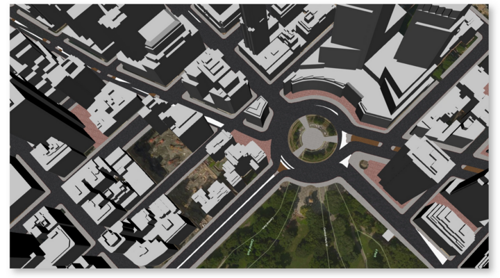
The Chair of Geoinformatics (TUM) presents an improved digital 3D city model of New York City. The generated CityGML compliant LoD2 datasets can be downloaded freely from our project website. While including new building models in LoD2, this city model especially provides detailed representations of the NYC street space. A total of over 500,000 street space objects are represented by integrating 11 thematic object classes such as ‘Roadbeds’, ‘Sidewalks’ or ‘Parking Lots’, all enriched with a variety of semantic information. The 3D model was entirely generated from NYC Open Data integrating more than 30 datasets into one consistent 3D city model. Additionally an ‘Open Source 3D Web Viewer’ is provided, allowing immediate interactive exploration and querying of the 3D model. The video linked below demonstrates the complexity of the city model generated and also includes a ‘3D Web Map Client’ demo.
Link to Youtube Demo Video: Click here
Online LoD2 Web Viewer: Click here
Project Website and Dataset Downloads: Click here
Project TUM-Wiki Page: Click here