Software
Please find a selection of software developed at the Chair of Geoinformatics on the individual sites. Find more information on these and other software on the Chair's GitHub repository
3D City Database
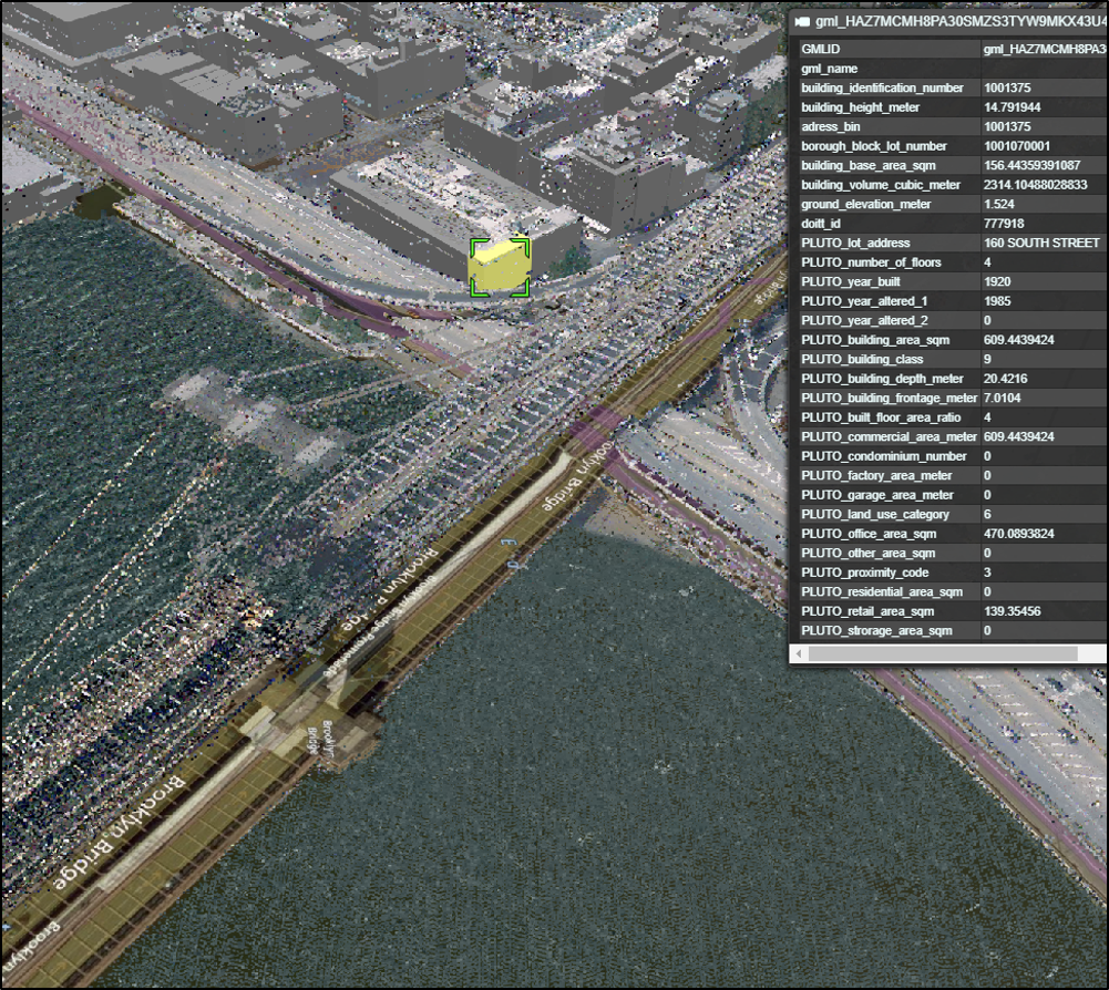
The award winning 3D City Database (3DCityDB) is a free 3D geo database to store, represent, and manage virtual 3D city models on top of a standard spatial relational database. The database model contains semantically rich, hierarchically structured, multi-scale urban objects facilitating complex GIS modeling and analysis tasks, far beyond visualization. It can be downloaded for free at www.3dcitydb.org or https://github.com/3dcitydb. The 3D City Database comes with additional software providing easy data exchange or facilitating coupling with cloud services. The 3D City Database content can be directly exported in KML, COLLADA, and glTF formats for the visualisation in a broad range of applications like Cesium WebGL, Google Earth, ArcGIS and ArcGIS Explorer. [more...]
r:trån - OpenDRIVE to CityGML converter
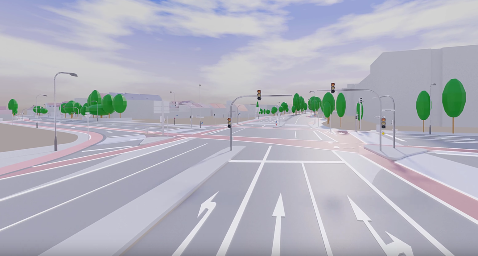
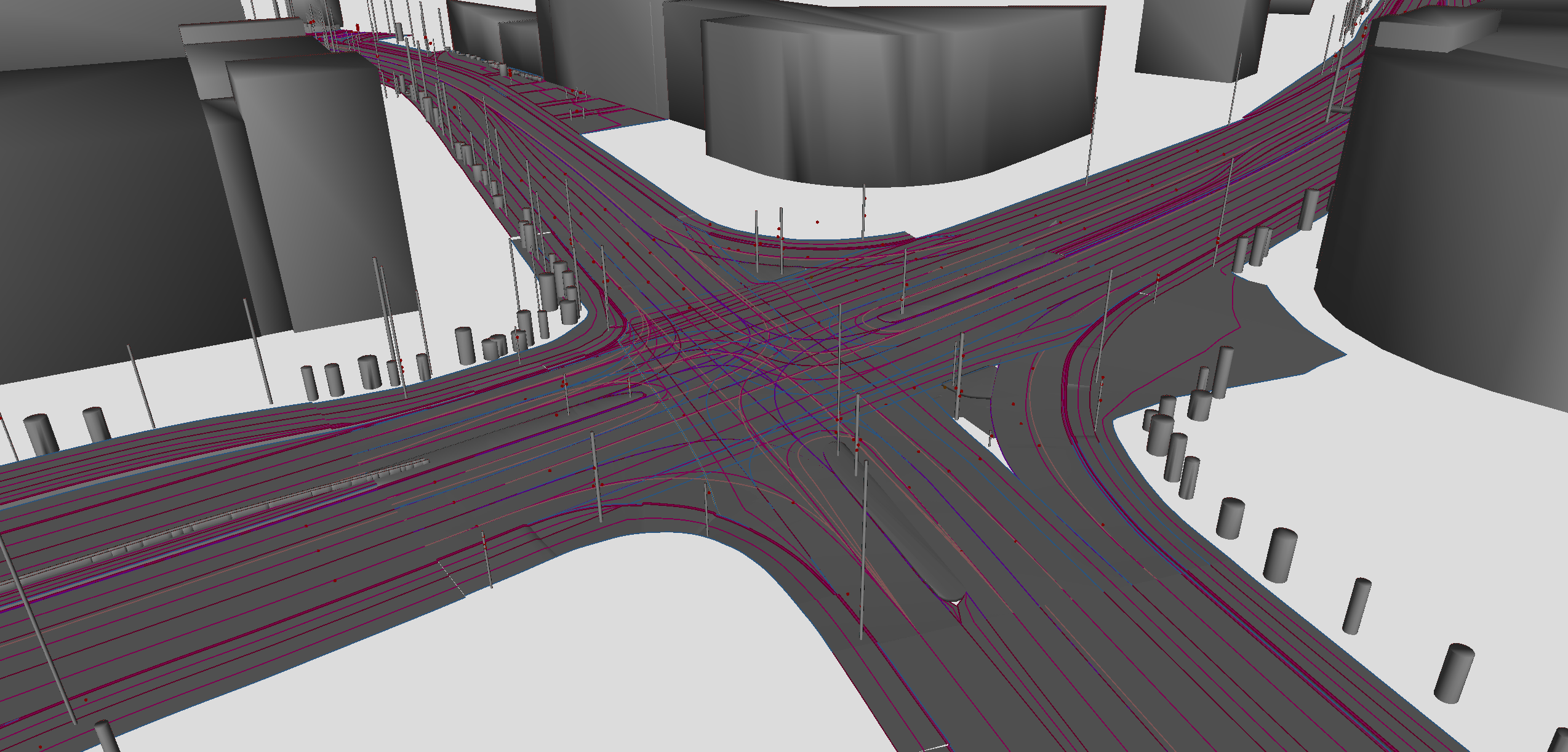
To test automated driving functions, highly-detailed reference maps are created and described in the road networks standard OpenDRIVE. As OpenDRIVE was developed for the very specific field of vehicle simulation, the tool support within the GIS domain is limited.
To bridge this gap, the Chair of Geoinformatics has published the road space transformer r:trån on GitHub. The open source project converts available OpenDRIVE datasets to the virtual 3D city model standard CityGML. The dual representation enables the usage of OpenDRIVE datasets within well-established GIS tools such as the 3DCityDB, QGIS and FME. Further demos and application examples can be found on the project website https://rtron.io. The project was developed in the context of the publicly funded research project SAVe which is led by AUDI AG and brings together several partners from industry, research and public administration.
InterSensorService
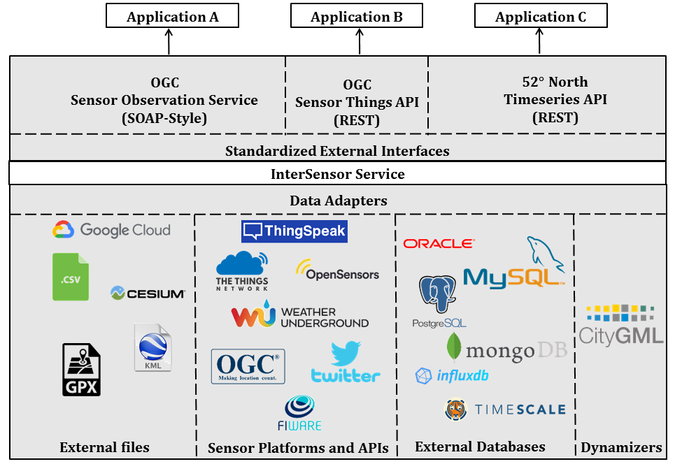
In many smart city projects, multiple stakeholders and companies are involved who use their own sensors and IoT devices which are managed by different platforms and APIs. In order to work within a common operational framework, sensor web infrastructures play a key role in providing interoperability between heterogeneous sensor platforms and observations. However, it is unlikely that all stakeholders would be willing to inject their proprietary data into a third-party data storage in the sensor web.
We introduce a new lightweight web service called InterSensor Service, which allows users to connect to multiple IoT platforms, databases and basic files and retrieving their observations without worrying about data storage and the multitude of different APIs. It is a Java application based on the Spring framework and is available as free and Open Source. Find more information on https://www.intersensorservice.org/ or on the corresponding GitHub page.
Cesium Point Cloud Generator
The Cesium Point Cloud Generator (CPCG) is a small Java-based tool for the generation of point cloud visualization datasets according to Cesium 3D Tiles. By utilizing a local portable SQLite database, it takes 3D point cloud datasets given as XYZ text files (possibly including RGB color information for each point) and generates a 3DTiles point cloud to be used for interactive 3D viewing using the Cesium WebGL Digital Globe. The tool is capable of generating multiple levels of detail to increase viewing performance. The generated point cloud datasets can be visualized in a Cesium-based web client, such as the 3DCityDB Web Map Client. Find more information on the corresponding GitHub page.