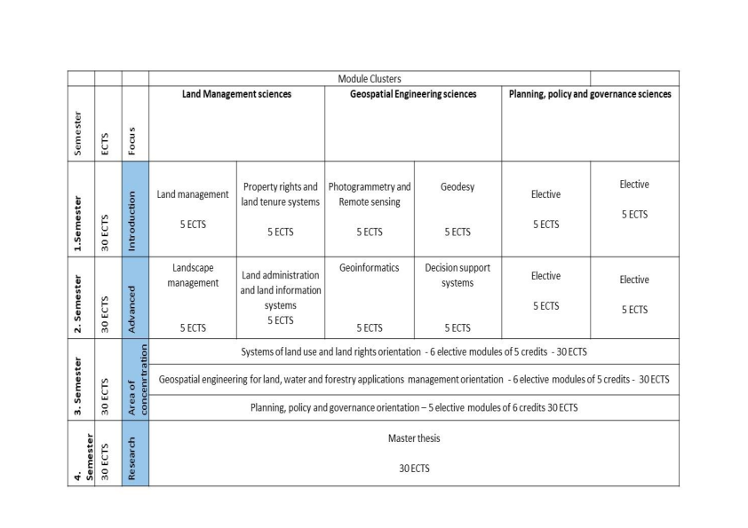
Study curriculum
The degree program comprises 4 semesters and 120 CP in total. An overview of the curriculum is given in table 1. Within the first two semesters the students gain skills in land management sciences, in geospatial engineering sciences and in policy, governance, management and research sciences. In the third semester the students choose one of three areas of concentration and finalize their studies in the fourth semester in writing their master’s thesis. The three areas of concentration:
- Land management theories and instruments
- Usage of geospatial methods and techniques
- Political and organizational aspects of land and geospatial interventions