CityGML is an international standard issued by the Open Geospatial Consortium (OGC) on the modeling, storage, and exchange of semantic 3D city models. Besides the spatial characteristics (location, shape, extent) and the appearance (colours, textures) semantic 3D city models explicitly represent the thematic structures and properties of the most relevant urban (but also rural) objects. CityGML defines common classes, attributes, and relationships for the representation of real world objects like buildings, bridges, tunnels, railways, water bodies, vegetation, terrain, and city furnitures. CityGML objects can be seen as the "digital twins" of the real world objects. Such semantic objects are not only suitable for 3D visualizations but especially for sophisticated analyses, for simulations as well as for urban facility and asset management. CityGML-based 3D city models are nowadays being used in Smart City projects.
The official 3D city models of many cities worldwide are structured according to the CityGML standard and are exchanged in the CityGML data format. The list of cities includes Munich, Nuremberg, Berlin, Frankfurt, Wiesbaden, Stuttgart, Karlsruhe, Düsseldorf, Dortmund, Cologne, Dresden, Leipzig, Hamburg, Hanover, Potsdam (all in Germany), Vienna and Salzburg (in Austria), Zurich and Geneva (in Switzerland), Rotterdam and The Hague (in the Netherlands), Brussels (Belgium), Singapore, New York City (USA), Helsinki (Finland). The official 3D building models of the German state mapping agencies (>50 million objects) as well as the national IMGeo3D standard of the Netherlands are based on CityGML.
CityGML was initiated in 2003 by Prof. Thomas H. Kolbe and was originally developed by the Special Interest Group 3D (SIG 3D) of the Initiative Geodata Infrastructure NRW (GDI NRW) jointly lead by Prof. Kolbe and PD Dr. Gerhard Gröger. By the end of 2004 CityGML was presented in the OGC for the first time. Shortly after, the OGC CityGML Standards Working Group (CityGML SWG) was founded. CityGML 1.0.0 was released as an international standard by the OGC in 2008. In 2012 version 2.0.0 was adopted as a standard. Prof. Kolbe is co-author of both versions and the Chair of Geoinformatics coordinates the ongoing creation of the specification documents and the data models for the upcoming version 3.0.0.
IndoorGML is an international standard of the Open Geospatial Consortium (OGC) on the modeling, storage, and exchange of 3D models for the purpose of indoor navigation. IndoorGML supports route planning as well as localization by different partitionings of the navigable interior space according to diverse subdivision criteria. At the core of the IndoorGML standard there is the so-called Multi-Layered Space-Event Model (MLSEM), managing and integrating the different decompositions of indoor spaces including the consideration of sensors for localization. The MLSEM was jointly developed by Prof. Thomas H. Kolbe, Thomas Adolphi (formerly Thomas Becker), Dr. Claus Nagel, and Dr. Robert Kaden. The work was carried out within the collaborative research project "Indoor Spatial Data Management" in the years 2008-2011 at TU Berlin (Prof. Thomas H. Kolbe) in cooperation with the University of Pusan (Prof. Ki-Joune Li), the University of Seoul (Prof. Jyeong Lee), TU Delft (Prof. Sisi Zlatanova), Aalborg University (Prof. Christian S. Jensen) and the University of Maine (Prof. Michael Worboys). The project was funded by the ministry of transport and mobility of South Korea. A detailed explanation of the MLSEM and especially of the mathematical properties including the geometric-topological consistency is provided in the PhD thesis of Dr. Claus Nagel with the title "Spatio-Semantic Modelling of Indoor Environments for Indoor Navigation".
The IndoorGML standard was specified by the IndoorGML Standard Working Group (IndoorGML SWG) of the OGC based on the MLSEM concept and lead by Prof. Ki-Joune Li, University of Pusan, and Prof. Jiyeong Lee, University of Seoul. Version 1.0 was released in January 2015 as a standard. Prof. Kolbe is co-author of the specification.
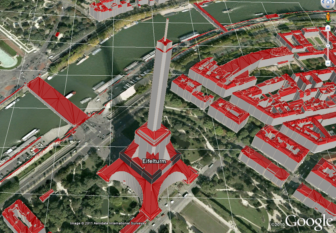
The Web 3D Service (W3DS) specification defines an interoperable interface for 3D geovisualization. The implementation of a W3DS generates georeferenced 3D scene graphs. These can be dynamically queried from a 3D viewer (like Google Earth or an X3D viewer). The 3D models of different W3DS can be integrated and jointly rendered within a viewer which allows for an interoperable integration of 3D models coming from different systems and data sources. Suitable data formats are e.g. X3D, VRML, KML, and COLLADA.
The W3DS was initiated in 2002 by Prof. Thomas H. Kolbe and was jointly developed with the members of the SIG 3D of the initiative Geodata Infrastructure NRW (GDI NRW) in Germany. The OGC published version 0.3.0 as a Discussion Paper in 2005. Later, Dr. Arne Schilling from the University of Heidelberg continued the developments and extended and revised the specification which then was published in 2010 with version 0.4.0 as another OGC Discussion Paper. Prof. Kolbe was co-author of both documents. Around the same time Dr. Benjamin Hagedorn from the University of Potsdam developed the Web View Service (WVS) for the generation of perspective views from 3D scenes. The WVS was also published as an OGC Discussion Paper. On the basis of W3DS and WVS Prof. Volker Coors from the University of Applied Sciences Stuttgart, Dr. Benjamin Hagedorn, and Simon Thum developed a new OGC standard called 3D Portrayal Service (3DPS). The 3DPS integrates and harmonizes the functionalities of the W3DS and WVS specifications; it was adopted as an OGC standard in 2016.
The CityGML UtilityNetwork ADE is an application domain extension (ADE) of the CityGML standard for the modeling and 3D representation of supply and disposal infrastructures. It supports the simultaneous and integrated representation of different kinds of utility networks, e.g. electricity, gas, district heating, telecommunication, fresh and waste water networks within one framework. Functional dependencies between components of different networks can be expressed and used in simulations of failures and cascading effects. Furthermore, network hierarchies (like the high, medium, and low voltage network) can be represented. Each network component is modeled both from its topographical view as a 3D object and its functional characteristics including the network topology. This dual representation supports 3D visualizations as well as the monitoring and comprehensive analyses of multi-utility networks.
The first version was jointly developed from 2009-2012 by Prof. Thomas H. Kolbe, Thomas Adolphi (formerly Thomas Becker), and Dr. Claus Nagel at TU Berlin in the context of the collaborative research project "Simulation of intersectorial cascading effects in the failure of critical infratructures using the virtual 3D city model of Berlin" (SIMKAS 3D) funded by the German ministry of science and research (BMBF). In the research study "Risk analysis on critical infrastructures", in which the Chair of Geoinformatics participated from 2015-2016, the model was extended by Dr. Tatjana Kutzner and Prof. Kolbe. In 2016 a special interest group was founded consisting of members from academia and industry who are now working the revision and finalization of the UtilityNetwork ADE. It is the aim to include the UtilityNetwork ADE as a regular module within a future version 3.x of the CityGML standard.
The CityGML Energy Application Domain Extension (ADE) augments the CityGML standard by classes, attributes, and relationships for representing energy-related information within semantic 3D city models (with a focus on 3D building models). On the basis of CityGML building models incl. the Energy ADE extensions simple up to comprehensive energetic simulations can be performed. For example, energy demands for heating, cooling, warm water preparation, and electricity can be estimated for individual buildings, city quarters, up to entire cities. The results of simulations can be stored and exchanged directly with the 3D models in an integrated way.
The Energy ADE is being developed since 2014 by an international consortium of members from academia, industry, and public administration. The roots lie on the one side in research work performed by the University of Applied Sciences Stuttgart (Prof. Volker Coors, Romain Nouvel) and the EIFER institute of the Karlsruhe Institute of Technology on an Energy ADE for CityGML. On the other side, Dr. Robert Kaden developed at the Chair of Geoinformatics during the same time an Energy ADE in his PhD thesis with the title "Calculation of the Energy Demands of Residential Buildings and Modeling of Energetic Parameters on the Basis of Semantic 3D City Models". Both research streams were harmonized and since then are being continued jointly by the international consortium.
The CityGML Dynamizer ADE is an application domain extension (ADE) of the CityGML standard for the modeling and representation of time-dependent variations of arbitrary CityGML object attributes, relations, and appearances. For this purpose, a new class called "Dynamizer" is being defined whose instances store time-dependent variations of values which explicitly override specific, otherwise static attribute values of CityGML objects within a 3D city model. This mechanism facilitates the replacement of the single, static value of an attribute like "electricity consumption in kWh" of a CityGML building object by timeseries data on the high frequently changing energy consumptions over some time period. Sources of these timeseries data can be tabulated values given as CSV files, OGC compliant TimeseriesML datasets, but also direct links to sensor services. Hence, Dynamizer objects can establish explicit relationships between sensors (and their observations) and the corresponding properties/attributes of a specific object within a 3D city model.
The Dynamizer ADE has been and is being further developed at the Chair of Geoinformatics by Kanishk Chaturvedi and Prof. Thomas H. Kolbe in the context of different Smart City projects. The development began in 2014 in the EU project "Modeling City Systems" funded by EIT Climate-KIC and is currently being continued within the Climate-KIC project "Smart Sustainable Districts". Within the context of the international project "Future Cities Pilot - Phase 1" of the Open Geospatial Consortiums we have implemented the Dynamizer ADE and used it for the coupling of 3D city models with sensors and simulations. It is planned to include the Dynamizer concept as an integral part of the next version of the CityGML standard (version 3.0.0).
Kolbe, Thomas H.; Donaubauer, Andreas; Beil, Christof (Ed.): Recent Advances in 3D Geoinformation Science – Proceedings of the 18th 3D GeoInfo Conference. Lecture Notes in Geoinformation and Cartography. Springer, 2024 more…BibTeX
Bachert, Carolin; León-Sánchez, Camilo; Kutzner, Tatjana; Agugiaro, Giorgio: Mapping the CityGML Energy ADE to CityGML 3.0 Using a Model-Driven Approach. ISPRS International Journal of Geo-Information 13 (4), 2024, 121 more…BibTeX
2023
Hamza Zahid: Integrating Regulatory Compliance into Urban Simulations: A Framework based on CityGML and XPlanung. Master thesis, 2023 more…BibTeX
Kutzner, Tatjana; Smyth, Carl; Nagel, Claus; Coors, Volker; Vinasco-Alvarez, Diego; Ishimaru, Nobuhiro; Yao, Zhihang; Heazel, Charles; Kolbe, Thomas H: OGC City Geography Markup Language (CityGML) Version 3.0 Part 2: GML Encoding Standard – International Standard, OGC Document No. 21-006r2. Open Geospatial Consortium, 2023 more…BibTeX
Stout, Dawson: Harnessing Geosensor Networks for Environmental Decision-Making: Water Management and Renaturation at the Kalterbach, Germany. Master thesis, 2023 more…BibTeX
2022
Wrabel, Tamira: Standards für den Digitalen Zwilling der Stadt. Bachelor thesis, 2022 more…BibTeX
2021
Kolbe, Thomas H.; Donaubauer, Andreas: Semantic 3D City Modeling and BIM. In: Shi, Wenzhong; Goodchild, Michael F.; Batty, Michael; Kwan, Mei-Po; Zhang, A. (Ed.): Urban Informatics. Springer, 2021 more…BibTeX
Kolbe, Thomas H.; Kutzner, Tatjana; Smyth, Carl Steven; Nagel, Claus; Roensdorf, Carsten; Heazel, Charles: OGC City Geography Markup Language (CityGML) Version 3.0 Part 1: Conceptual Model Standard – International Standard, OGC Document No. 20-010. Open Geospatial Consortium, 2021 more…BibTeX
Kutzner, Tatjana; Donaubauer, Andreas: CityGML 3.0 – Neue Konzepte und Perspektiven für einen Digitalen Lageplan in 3D. Geoinformationssysteme 2021 - Beiträge zur 8. Münchner GI-Runde, 2021, 55-57 more…BibTeX
Wilhelm, Laura; Donaubauer, Andreas; Kolbe, Thomas H.: Integration of BIM and Environmental Planning: The CityGML EnvPlan ADE. Journal of Digital Landscape Architecture (6-2021), 2021 more…BibTeX
2020
Akahoshi, Kentaro; Ishimaru, Nobuhiro; Kurokawa, Chikako; Tanaka, Yuichi; Oishi, Tomohisa; Kutzner, Tatjana; Kolbe, Thomas H.: i-Urban Revitalization: Conceptual Modeling, Implementation, and Visualization Towards Sustainable Urban Planning Using CityGML. Proceedings of the XXIV ISPRS Congress (ISPRS Annals of Photogrammetry, Remote Sensing and Spatial Information Sciences), Copernicus GmbH, 2020, 179-186 more…BibTeX
Beck, Fritz; Borrmann, André; Kolbe, Thomas H.: The need for a differentiation between heterogeneous information integration approaches in the field of “BIM-GIS Integration”: a literature review. Proceedings of the 3rd International BIM GIS Integration Workshop (ISPRS Annals of the Photogrammetry, Remote Sensing and Spatial Information Sciences), 2020 more…BibTeX
Elfouly, Mostafa; Labetski, Anna: Flood Damage Cost Estimation in 3D based on an Indicator Modelling Framework. Geomatics, Natural Hazards and Risk 11 (1), 2020 more…BibTeX
Gilbert, Thomas; Rönsdorf, Carsten; Plume, Jim; Simmons, Scott; Nisbet, Nick; Gruler, Hans-Christoph; Kolbe, Thomas H.; van Berlo, Léon; Mercer, Aidan: Built environment data standards and their integration: an analysis of IFC, CityGML and LandInfra. , Ed.: Integrated Digital Built Environment (IDBE) Joint Working Group of OGC and bSI: Open Geospatial Consortium; buildingSMART International, 2020, more…BibTeX
Ishimaru, Nobuhiro; Kurokawa, Chikako; Tanaka, Yuichi; Oishi, Tomohisa; Akahoshi, Kentaro; Kutzner, Tatjana; Kolbe, Thomas H.: CityGML Urban Planning ADE for i-Urban Revitalization. Open Geospatial Consortium, 2020, more…BibTeX
Kutzner, Tatjana; Chaturvedi, Kanishk; Kolbe, Thomas H.: CityGML 3.0: New Functions Open Up New Applications. PFG – Journal of Photogrammetry, Remote Sensing and Geoinformation Science, 2020, 19 more…BibTeX
Kutzner, Tatjana; Donaubauer, Andreas: Neue Konzepte in CityGML 3.0 und ihr Beitrag zum Building Information Modeling. FuB – Flächenmanagement und Bodenordnung, Zeitschrift für Liegenschaftswesen, Planung und Vermessung (6), 2020, 7 more…BibTeX
2019
Bolduan, Tobias: A new approach for integrating BIM and GIS based on Model View Definition and Profiling Geospatial Application Schemas. Master thesis, 2019 more…BibTeX
2018
Kutzner, Tatjana; Kolbe, Thomas H.: CityGML 3.0: Sneak Preview. PFGK18 - Photogrammetrie - Fernerkundung - Geoinformatik - Kartographie, 37. Jahrestagung in München 2018 (Publikationen der Deutschen Gesellschaft für Photogrammetrie, Fernerkundung und Geoinformation (DGPF) e.V.), Deutsche Gesellschaft für Photogrammetrie, Fernerkundung und Geoinformation e.V., 2018, 835-839 more…BibTeX
2017
Chaturvedi, Kanishk; Kolbe, Thomas H.: Future City Pilot 1 Engineering Report – Public Engineering Report. Open Geospatial Consortium, Open Geospatial Consortium, 2017, more…BibTeX
Hijazi, Ihab; Kutzner, Tatjana; Kolbe, Thomas H.: Use Cases and their Requirements on the Semantic Modeling of 3D Supply and Disposal Networks. Kulturelles Erbe erfassen und bewahren - Von der Dokumentation zum virtuellen Rundgang, 37. Wissenschaftlich-Technische Jahrestagung der DGPF (Publikationen der Deutschen Gesellschaft für Photogrammetrie, Fernerkundung und Geoinformation (DGPF) e.V.), Deutsche Gesellschaft für Photogrammetrie, Fernerkundung und Geoinformation e.V., 2017, 288-301 more…BibTeX
Vilgertshofer, Simon; Amann, Julian; Willenborg, Bruno; Borrmann, André; Kolbe, Thomas H.: Linking BIM and GIS Models in Infrastructure by Example of IFC and CityGML. In: Computing in Civil Engineering 2017. American Society of Civil Engineers (ASCE) Library, 2017, 133-140 more…BibTeX
2016
Chaturvedi, Kanishk; Kolbe, Thomas H.: Integrating Dynamic Data and Sensors with Semantic 3D City Models in the context of Smart Cities. Proceedings of the 11th International 3D Geoinfo Conference (ISPRS Annals of the Photogrammetry, Remote Sensing and Spatial Information Sciences), ISPRS, 2016 more…BibTeX
Kutzner, Tatjana; Kolbe, Thomas H.: Extending Semantic 3D City Models by Supply and Disposal Networks for Analysing the Urban Supply Situation. Lösungen für eine Welt im Wandel, Dreiländertagung der SGPF, DGPF und OVG, 36. Wissenschaftlich-Technische Jahrestagung der DGPF (Publikationen der Deutschen Gesellschaft für Photogrammetrie, Fernerkundung und Geoinformation (DGPF) e.V.), Deutsche Gesellschaft für Photogrammetrie, Fernerkundung und Geoinformation e.V., 2016, 382-394 more…BibTeX
2015
Kaden, Robert; Elfouly, Mostafa; Kolbe, T.H.: The CityGML Energy ADE - An International Standardization Effort for the Extension of 3D City Models to Support Energetic Building Analysis. Innovations for Energy Systems, Mobility, Buildings and Materials, printy - Digitaldruck & Kopierservice, 20155th Energy Colloquium of the Munich School of Engineeringmore…BibTeX
Zirak, Maryam: A Model-driven Approach for Linking Building Thermal Energy Assessment Standards and the CityGML Energy Application Domain Extension (ADE) using UML. Master thesis, 2015 more…BibTeX
2014
Kolbe, Thomas H.; Kutzner, Tatjana; Gröger, Gerhard; Casper, Egbert: CityGML - Der OGC-Standard CityGML geht in die nächste Runde. gis@work (1), 2014, 42-43 more…BibTeX
Lee, Jiyeong; Li, Ki-Joune; Zlatanova, Sisi; Kolbe, Thomas H.; Nagel, Claus; Becker, Thomas: Lee, Jiyeong; Li, Ki-Joune; Zlatanova, Sisi; Kolbe, Thomas H.; Nagel, Claus; Becker, Thomas (Ed.): OGC Indoor Geography Markup Language (IndoorGML) Implementation Standard – OGC International Standard, Doc. No. 14-005-r3. Open Geospatial Consortium (Version 1.0.0. edn.), 2014 more…BibTeX
2013
Becker, Thomas; Nagel, Claus; Kolbe, Thomas H.: Semantic 3D modeling of multi-utility networks in cities for analysis and 3D visualization. In: Pouliot, Jacynthe; Daniel, Sylvie; Hubert, Frédéric; Zamyadi, Alborz (Ed.): Progress and New Trends in 3D Geoinformation Sciences. Springer, 2013, 41-62 more…BibTeX
Donaubauer, Andreas: International SIG 3D and OGC Workshop on Requirements for CityGML 3.0, 20.-21. Juni 2013, Technische Universität München. PFG - Photogrammetrie, Fernerkundung, Geoinformation (6), 2013, 620-622 more…BibTeX
Gröger, Gerhard; Kutzner, Tatjana; Kolbe, Thomas H.: A CityGML-based encoding for the INSPIRE Data Specification on Buildings. INSPIRE Conference 2013, 2013 more…BibTeX
Löwner, Marc-O.; Casper, Egbert; Becker, Thomas; Benner, Joachim; Gröger, Gerhard; Gruber, Ulrich; Häfele, Karl-Heinz; Kaden, Robert; Schlüter, Sandra: CityGML 2.0 – Ein internationaler Standard für 3D-Stadtmodelle Teil 2: CityGML in der Praxis. zfv – Zeitschrift für Geodäsie, Geoinformation und Landmanagement (02/2013), 2013, 131-143 more…BibTeX
2012
Gröger, Gerhard; Kolbe, Thomas H.; Nagel, Claus; Häfele, Karl-Heinz: OGC City Geography Markup Language (CityGML) Encoding Standard – OGC Document No. 12-019. Open Geospatial Consortium (2.0.0. edn.), 2012 more…BibTeX
2011
Becker, Thomas; Nagel, Claus; Kolbe, Thomas H.: Integrated 3D Modeling of Multi-utility Networks and Their Interdependencies for Critical Infrastructure Analysis. In: Advances in 3D Geo-Information Sciences. Springer, 2011, 1--20 more…BibTeX
2010
Nagel, Claus; Becker, Thomas; Kaden, Robert; Li, Ki-Joune; Lee, Jiyeong; Kolbe, Thomas H.: Requirements and Space-Event Modeling for Indoor Navigation - How to simultaneously address route planning, multiple localization methods, navigation contexts, and different locomotion types. 2010 more…BibTeX
Schilling, Arne; Kolbe, Thomas H.: Candidate OpenGIS® Web 3D Service Interface Standard Version 0.4.0. Open Geospatial Consortium Discussion Paper, OGC Doc. No. 09-104r1, 2010 more…BibTeX
2009
Becker, Thomas; Nagel, Claus; Kolbe, Thomas H.: A multilayered space-event model for navigation in indoor spaces – 5. In: Lee, Jiyeong; Zlatanova, Sisi (Ed.): 3D Geo-Information Sciences. Springer, 2009, 61--77 more…BibTeX
Becker, Thomas; Nagel, Claus; Kolbe, Thomas H.: Supporting Contexts for Indoor Navigation Using a Multilayered Space Model. 2009 Tenth International Conference on Mobile Data Management: Systems, Services and Middleware, IEEE, 2009 more…BibTeX
Kolbe, Thomas H.: Representing and Exchanging 3D City Models with CityGML – 2. In: Lee, Jiyeong; Zlatanova, Sisi (Ed.): 3D Geo-Information Sciences. Springer, 2009, 15--31 more…BibTeX
2008
Gröger, Gerhard; Kolbe, Thomas H.; Czerwinski, Angela; Nagel, Claus: Gröger, Gerhard; Kolbe, Thomas H.; Czerwinski, Angela; Nagel, Claus (Ed.): OpenGIS City Geography Markup Language (CityGML) Encoding Standard, Version 1.0.0 – OGC Document No. 08-007r1. Open Geospatial Consortium (1.0.0. edn.), 2008 more…BibTeX
2006
Kolbe, Thomas H.; Bacharach, Sam: CityGML: An Open Standard for 3D City Models. Directions Magazine, 2006 more…BibTeX
2005
Kolbe, Thomas H.; Gröger, Gerhard; Plümer, Lutz: CityGML – Interoperable Access to 3D City Models. Proceedings of the International Symposium on Geo-information for Disaster Management (Gi4DM) on 21.-23. March 2005 in Delft, Springer, 2005 more…BibTeX
Quadt, Udo; Kolbe, Thomas H.: OpenGIS® Web 3D Service Interface Standard Version 0.3.0. 2005 more…BibTeX
Kolbe, Thomas H.: Interoperable 3D-Geovisualisierung – 28. In: Bernard, Lars; Fitzke, Jens; Wagner, Roland (Ed.): Geodateninfrastruktur - Grundlagen und Anwendungen. Wichmann Verlag, 2004, 247--257 more…BibTeX
Kolbe, Thomas H.; Gröger, Gerhard: Unified Representation of 3D City Models. Geoinformation Science Journal 4 (1), 2004 more…BibTeX
2003
Altmaier, Angela; Kolbe, Thomas H.: Applications and solutions for interoperable 3D geo-visualization. Proceedings of the Photogrammetric Week 2003 in Stuttgart, Wichmann Verlag, 2003 more…BibTeX
Kolbe, Thomas H.; Gröger, Gerhard: Towards unified 3D city models. Proceedings of the Joint ISPRS Commission IV Workshop on Challenges in Geospatial Analysis, Integration and Visualization II in Stuttgart 2003, ISPRS, 2003 more…BibTeX